AMAZONIS MENSA · MARS EXPRESSOne landscape. Two ways to reshape it.
Wind carved. Lava covered.
Ridges preserve a record of material being worn away. Faint crater rims tell a different story: material covering what came before.
Inspect this place on the Mars globe ↗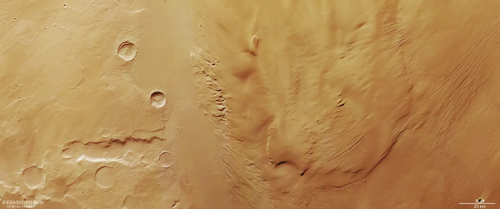
Read the shapes, not a weather forecast.
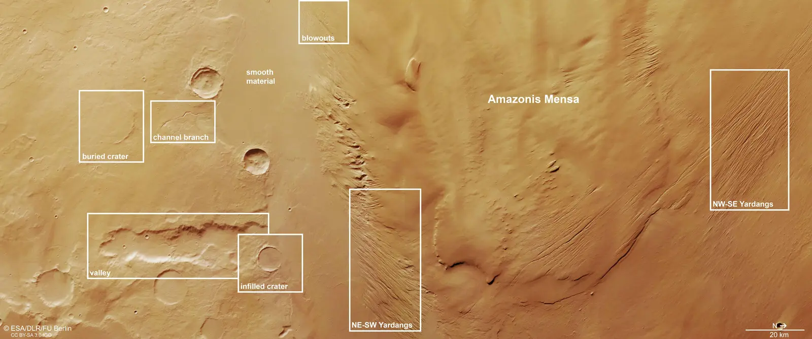
ESA and FU Berlin identify elongated ridges called yardangs, formed by wind-driven abrasion, plus crescent-shaped blowouts. The annotated image shows two differently aligned ridge groups around Amazonis Mensa. These are traces left in terrain—not wind measurements made on the image date.
In the globe explorer, choose the ridges, pan around the source labels, then switch labels off to inspect the underlying image. Comparing the same scene with and without labels helps separate what you can see from the explanation supplied by the mission team. Image panning does not move a geographic marker.
Inspect the official annotationsArrow keys or touch to pan; close to return
A crater can survive as a nearly hidden rim.
The source labels both a buried crater and an infilled crater, alongside a valley and a narrower channel branch. Smooth material covers parts of this older landscape. FU Berlin interprets it as likely lava from the Hesperian period, approximately 3.7–2.9 billion years ago.
Try finding the faint rim without labels, then turn them back on. A filled depression and an eroded ridge represent different ways of changing relief: adding material versus removing it. That comparison is useful even though this single observation does not measure how quickly either process occurred.
Compare the landforms in Mars ↗A regional anchor, not a pinpoint claim.
- Globe locator
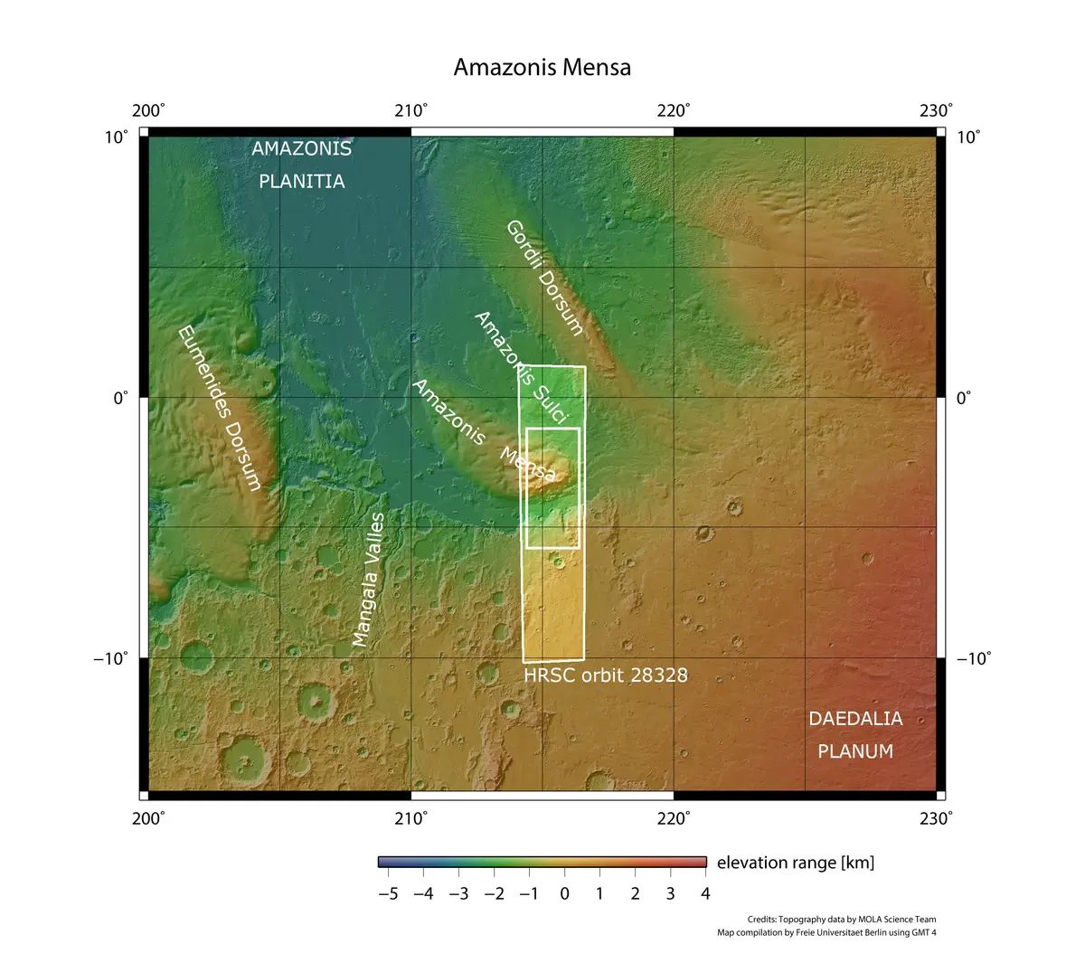
- Approximately 3°S, 215°E: the published HRSC image center, not a surveyed summit or an exact yardang coordinate.
- Original resolution
- Approximately 24 metres per pixel. CaptureMars previews are resized; their pixels do not retain that ground scale.
- Evidence limits
- No measured present wind direction or intensity, active lava, current erosion rate, current water, life, hazard, safety or settlement-approval conclusion. The lava interpretation is qualified; the image is not a live feed.