ARSIA MONS FIELD NOTE OBSERVATION + MODEL
A cloud longer
than many countries.
Follow one observed morning near Arsia Mons, then compare what Mars Express saw with what a regional model suggests.
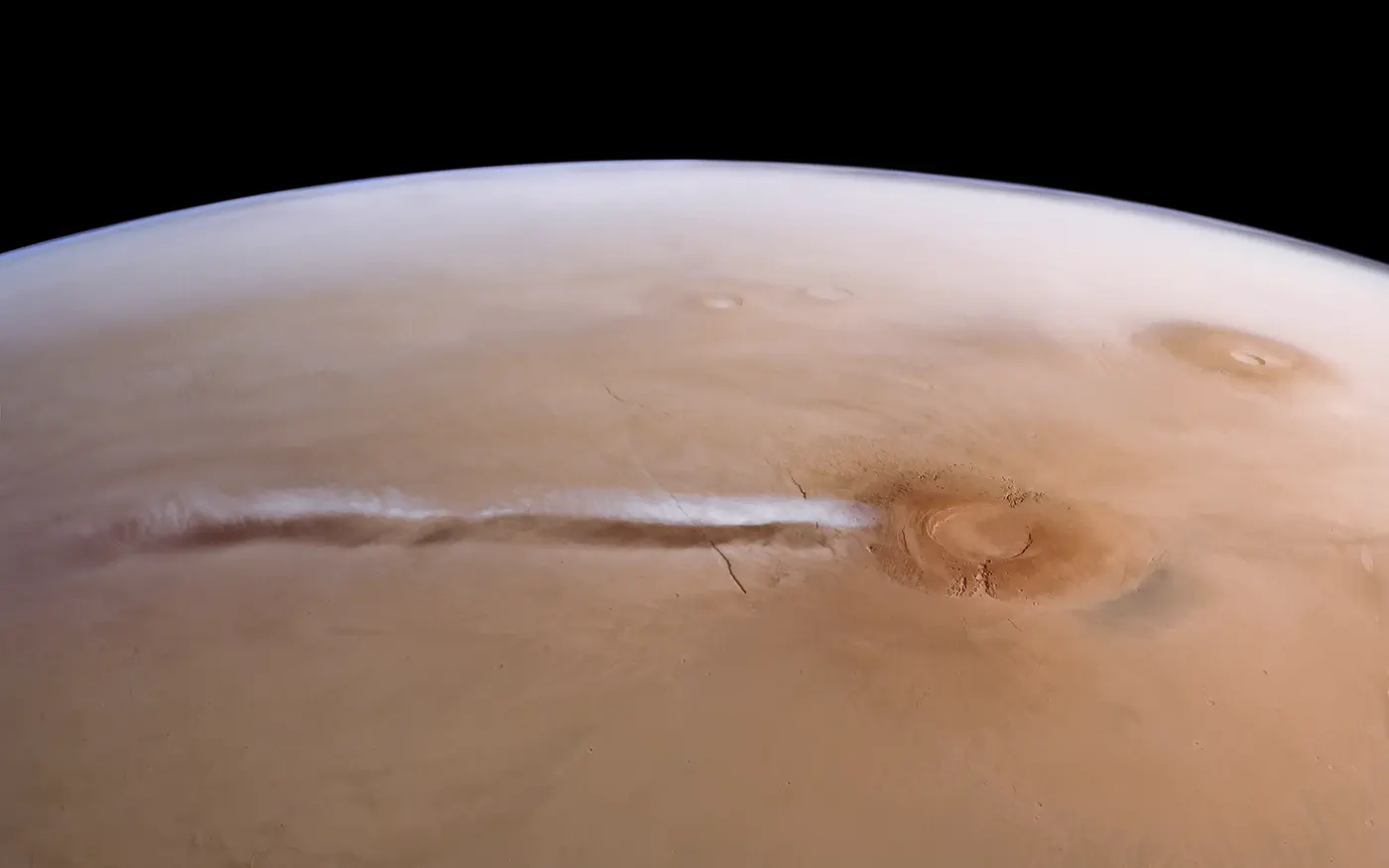
ESA/DLR/FU Berlin · processing and acknowledgement J. Cowart · ESA image record ↗
01 / WATCH ONE MORNING
Observed cloud. Modelled mechanism.
OBSERVED
Morning recurrence
Mars Express has observed the water-ice cloud during Martian southern spring and summer mornings.
MODEL
Air rises
A regional model sends air upward over the roughly 20-kilometre-high Arsia Mons volcano.
MODEL
Rapid cooling
In the simulation, a gravity wave lifts air parcels several kilometres and cools them about 30°C in 10 minutes.
MODEL
Ice nucleates
The model reproduced a cloud when water vapour froze directly without dust particles acting as seeds.
OBSERVED
Long morning plume
The recurring cloud can extend up to about 1,800 kilometres downwind before fading later in the morning.
The labels matter: Mars Express observations establish the cloud’s appearance and recurrence; the model proposes a physical explanation. CaptureMars does not turn the model into a measured wind field or a live forecast.
Back to choices ↑02 / COMPARE THE EVIDENCE
A useful model that does not match everything.

ESA says the simulation’s timing, duration and cloud length do not exactly match the observations. Those differences are not a failure hidden by the visualization; they show where the explanation still needs work.
- Study
- Hernández-Bernal and colleagues, published online in Nature Geoscience
- Evidence
- Mars Express VMC, HRSC and OMEGA observations plus a regional atmospheric model
- Globe anchor
- Arsia Mons summit region. The marker uses the centre coordinate published with a NASA THEMIS summit-caldera image; it is not an exact cloud-origin point or mapped cloud boundary.
- Not established
- Current cloud presence, live wind direction or intensity, current weather, liquid water, life, habitability, safety or human zoning
Read ESA’s October 7 report ↗ · Open the peer-reviewed study record ↗ · Check the NASA summit-region locator ↗
Back to choices ↑